


Bring ATLHAS to your Platform
Ready for integration, built for the field. Embed ATLHAS into your existing infrastructure or use our standalone app for instant, proactive data verification
Challenge & Needs
Digital data to be verified?
In the era of deepfakes and digital deception, businesses and individuals of integrity face a growing need to guarantee the veracity of their documentation. This is essential to boost e-sales conversions, increase operational efficiency, and comply with tightening administrative, regulatory, and legal procedures regarding the authenticity, provenance, and traceability of digital files and documents.
In this context, transparent organizations are forced to incur excessive costs to mitigate risks such as:
Fake Data-acquisition
Falsification of location and timestamp
Loss of digital traceability / Chain of trust breaches
Complexities in verification processes
The ATLHAS System
ATLHAS technology* allows certifying the authenticity of position, date and time, of facts and events captured with mobile devices, including photos, videos and tracking. By integrating secure data directly from space via Galileo, the European satellite navigation system, ATLHAS goes beyond traditional timestamping establishing a new global standard for digital trust.
Unlike traditional methods, ATLHAS embeds a secure satellite signature into the metadata, creating a sealed dataset with file, time and space. This indissoluble link guarantees that the data is, and will always remain, unalterable.
The ATLHAS Certification of Authenticity provides definitive proof of integrity. It ensures that no element within the chain of trust can be altered, regardless of time or the number of digital exchanges.
* Patent registered
How It Works
Capture live events or files with a single tap on your mobile device. ATLHAS instantly anchors your media to certified Galileo satellite data, storing it within the secure ATLHAS vault for permanent verification.
ATLHAS monitors and verifies trusted location and time signals from authenticated Galileo satellites, confirming they have not been manipulated.
A cryptographic hash of file is associated with the authenticated location/time data and then recorded to blockchain for immutable proof.
By combining visual forensics with certified GNSS metadata, ATLHAS enables the detection of manipulated images.
At any later time, the certified file can be verified against the original GNSS timestamp and location data to confirm its authenticity. This ensures a permanent chain of trust, making data integrity the foundation for reduced operational costs and increased prosperity.
The certification is done via ATLHAS dedicated receivers + App or SDK with seamless integration into client applications.
Designed for Everyone
ATLHAS deploys a full range of protocols and advanced tools built to safeguard data integrity and transparency for all. Its user-friendly surface makes advanced verification accessible instantly.
Ready for integration, built for the field. Embed ATLHAS into your existing infrastructure or use our standalone app for instant, proactive data verification
From our robust SDK for custom integrations to dedicated hardware receivers, we provide the tools to build an unbreakable chain of trust for any application
Security
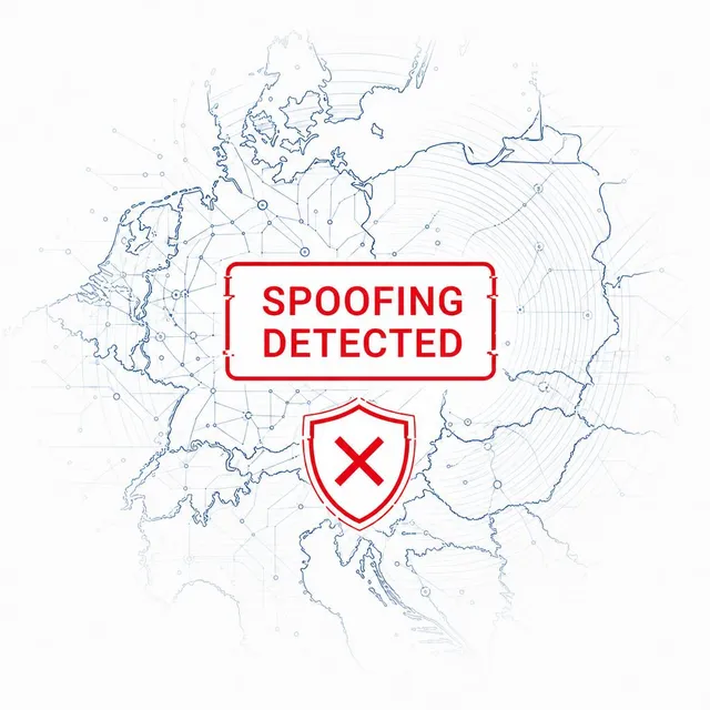
To combat the growing risk of Deep Fake Positioning and to protect your transparency, ATLHAS platform integrates robust anti-spoofing services. These services are designed to detect and flag any attempts to manipulate or fake the reported geographical coordinates and timestamps (even fake photos).
By continuously analyzing data for inconsistencies and signs of digital tampering, ATLHAS ensures integrity and authenticity of all location and time-based evidence. This proactive approach provides security and trust for all our geospatial data processing.
Core Advantages
Galileo OS-NMA + ATLHAS GEO-TAG Verification provide unalterable authentication of both position and timestamp, critical for probative value of the content
Guarantee of multimedia content integrity, enabling the detection of manipulated images and ensuring photos, videos and tracking are authentic and unaltered since the moment of capture
Precise verification of device and account identity, ensuring all data is tied to authenticated credentials and device ownership for maximum accountability
Multi-layered encryption and secure cryptographic protocols, leveraging blockchain technology for immutable proof
Multi-frequency GNSS with SBAS and RTK correction, delivering unmatched positioning accuracy, up to 2 cm with RTK
App or SDK with seamless integration into client applications and dedicated receivers for comprehensive certification
High Precision
ATLHAS also delivers centimeter-level precision through advanced multi-frequency GNSS positioning with SBAS and RTK correction technologies.
ATLHAS combines multiple satellite constellations and real-time corrections to achieve positioning accuracy that exceeds industry standards, ensuring every authenticated location meets the most demanding professional requirements for verification and compliance.
Up to
0 cm
With SBAS
Up to
0.0 cm
With RTK
Operational Scenarios
Drone Flight Certification

Car/Trucks Movement Certification
Insurance Compliance Tracking

Food Supply-Chain Traceability
Legal & Notarial Verification
Anti-fraud Audit Trail

Agri-environmental Monitoring
Maritime & Port Logistics
Strategic Value
Turning Certified Integrity into Tangible Business Value
Streamlined compliance and regulatory workflows.
Significant reduction in administrative and auditing expenses.
Higher e-commerce conversion through automated truth-validation.
Scalable product onboarding via remote, "on-site-free" verification.
Optimized operations through enhanced man-hour efficiency.
Strengthened corporate reputation and social transparency.
Verified oversight of safety-critical personnel and operations.
Guaranteed compliance with safety-critical shifts and rosters.
Data-driven Fatigue Risk Management (FRM).
Solutions
Designed to be used both by Space Data Experts and Private Citizens, Meeting needs of every user expertise level.
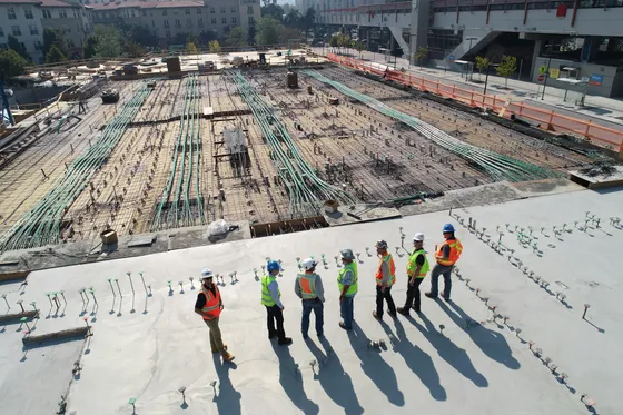
Certified Progress & Infrastructure Monitoring
Certifies the progress and the conditions of worksites, validating: industrial and urban infrastructures, quarries, dumps, etc., ensuring compliance with maintenance tasks & project plans.

Certified Requests & Damage Assessment
Authenticates visual media and data to streamline both online sales requiring data-validation and claims-processing, preventing fraud. This ensures that submitted evidence are unalterable and verifiable, reducing processing times for insurers.

Certified Handover & Condition Verification
ATLHAS solves the "Chain of Custody" challenge by certifying the exact time and location of parcel handovers, as well as the condition of goods at key checkpoints, reducing liability for lost or damaged shipments.
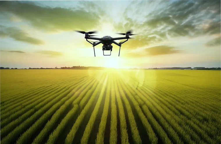
Agricultural Compliance
Enables farmers to certify the information of their "Aid Applications"
Replaces expensive and often delayed ground checks where satellite monitoring alone is not feasible
Enables Paying Agencies to automate and validate their review, preserving their resources and EU/national funds
Enables earlier & safer validations and payments to the farmers
Aerial Surveys
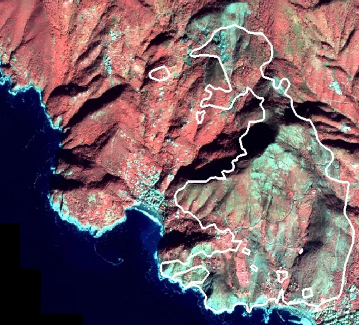
ATLHAS technology allows precise perimeter mapping and detailed tracking for both drone and aerial surveys. It embeds unalterable evidence of location and timestamp within the recorded multimedia files (photos, videos).
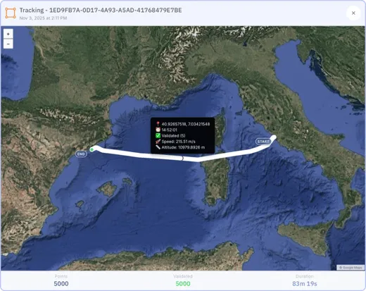
This guarantees the unequivocal authentication of a drone's flight path, an aerial inspection, or the secure traceability of any defined movement, such as the log of a commercial flight.
The resulting authentication grants the content (position, time, direction) undeniable proof, crucial for regulatory compliance, legal affairs, and insurance purposes.
Benefits
ATLHAS certified geotagged solutions enable organizations and stakeholders to reduce the need for on-site inspections, saving resources and providing reliable alternatives.
ATLHAS enables authenticated, faster and more efficient workflows.
ATLHAS can replace on-site inspections through automated verifications.
ATLHAS ensures and certifies the operational truth when using, processing, and transmitting digital data.
Get in Touch
Every great solution starts with a conversation. Tell us about your current challenges and let's discuss your needs in detail.